Huge stormfront rolls across NSW
Click on images below for full size pics
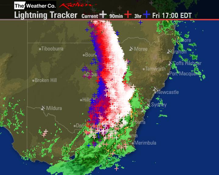
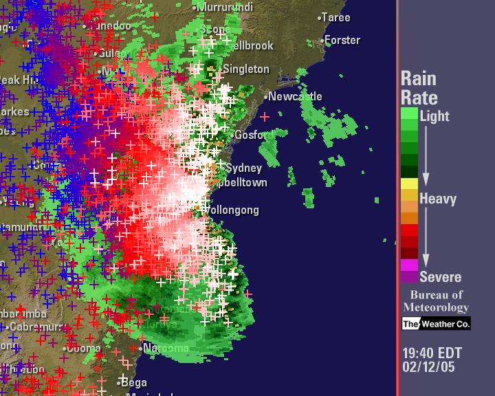
I could see this storm approaching from the west on the weather radar. It was a monster, stretching
~ 1000km from the NSW-VIC border in the south to the NSW-QLD in the north. The CAPE and LFTX
from GFS were around 2200 and -6 respectively. This was going to be a GOOD DAY !!. Heading west
out the M4 motorway, I was greeted by the storms' shelf cloud as it started to come down off the hills.
.jpg)
.jpg)
Getting off the motorway and heading south on the Old Northern Rd, I found a good clear spot to take
photos. A good gustfront developed. I let it pass overhead before heading east to Bonnyrigg area to
find a sheltered place to take some lightning pix.
.jpg)
.jpg)
.jpg)
Lightning pix from Bonnyrigg area.
.jpg)
.jpg)
After staying there for a while taking some pix and video, I finally headed towards home via the
Cumberland Hwy and the M4 and was treated to several excellent lightning discharges.
.jpg)
.jpg)
.jpg)
Below CAPE from GFS and Lightning Tracker/Radar image courtesy of Weatherzone and BOM

copyright Dave Nelson 2006
Updated 14 Oct 2006
 To Top
 To Chase Index