This turned into a wonderful day for the stormchaser and one of the few days where I was able to combine work
and pleasure. Work took me down to Wollongong then across the Illawarra Highway to Bowral for my second job.
Approaching Bowral, I could watch these 2 cells growing in size and the anvil becoming more prominent. These
were the first 2 of 6 individual storm cells I observed today.The cell to the south of Bowral moved out towards the
coast, it was the one due west of the town that hit it head on.
Click on images below for full size pics
west of Bowral ................. South of Bowral
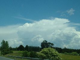
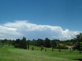
By the time I finished my work (1230hrs) in the local shopping centre, light rain had started falling and the anvil was
well overhead and thunder rumbles could be heard. Locals told me of Mt. Gibraltar lookouts that were a close quick
drive away. I observed some nice CG's whilest driving up the mountain. The view was great .... Bowral and beyond
to the west and Mittagong in the valley to the north. The view of the torrential rain and hail moving across the valleys
was awesome as everything in their path disappeared from view.
This storm was very active, the thunder was almost continuous with many CC's and some good CG's. Ohhh its so
hard to photo looking straight up into the clouds with rain and hail falling. Where I was, hail got up to ~ 1 cm max.
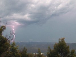
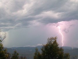
The left pic is the 5th of 5 strikes down the same path, there were 3 bright and 2 fainter discharges.
This is looking north with Mittagong down in the valley. All the strikes were happening where these ones were,
on the range of hills behind Mittagong. This was the 3rd individual cell I observed passing through the region.
Here is the .avi movie for Left strike .. 990 kb
Here is the .avi movie for Right strike .. 412 kb
From Mt Gibraltar I drove down and through Mittagong and up onto the freeway heading north to Campbelltown.
I could see the next big storm coming in off the western mountains. I turned off the freeway at the Bargo exit and by
the time I got to Bargo the lightning was zapping all around and within minutes the torrential rain started. Below is
2 frames showing a double strike almost directly above me. Yes that is the window wiper across the frame.
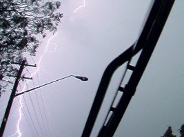
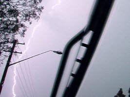
Here is the .avi movie this strike .. 822 kb
The driving conditions from Bargo to Picton and up to Campbelltown were shocking !! about the worst I had ever
encountererd with streams of water flowing across the roads, much surface flooding and torrential rain giving low visibility.
The next storm came through whilst I was at Campbelltown and it moved roughly NE over Sydney. The previous cell that
passed over me in the Picton area could be seen to the south of this new cell as it moved out to the coast.
My next job was in the Mt Pritchard area and whilst there the next cell came over head. I had no opportunity to photograph
this one. One close CG strike really rattled the windows and caused a brief power outage. It brightly lit up the office I was
working in at the time.
I followed this storm home and watched it drop some nice CG's over the Granville and Auburn areas.
copyright Dave Nelson 2004
 To Top
 To Chase Index