Storm report for March 03, 2005
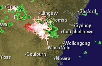
I could see the storm clouds building to the SW of Sydney on my way home from work. I was only home 30 mins
and after looking at the radar images decided to intercept the active cell heading towards Sydney from the
Campbelltown area. A note to myself: ... "why does the need to travel to storms often co-incide with peak-hour
traffic ?!!". Haha ... so frustrating ... several times this season its stopped me getting to location before
the storm arrived, giving me no chance to prepare for its arrival.
050303 1510EST

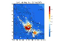
050303 0600UT Cape

Click on images below for full size pics
I finally got through the traffic jam to the back of the runway and started photographing the strikes.
I got as far as Bankstown airport and the storm had already arrived there. Large close CG's were already
dropping around me, it was nice to see a couple of them fragment into "droplets" as strike died off,
that is only an occassionally seen phenonema.
 1 thumb.jpg)
 3 thumb.jpg)
 1 thumb.jpg)
Above ... 1st 2 pics - a strike jst sth of Airport, 3rd pic - a strike over nth end of airport
Below ... 2 sets of 3 pics of 2 separate strikes over nth end of airport
 01 thumb.jpg)
 09 thumb.jpg)
 22 thumb.jpg)
 1 thumb.jpg)
 2 thumb.jpg)
 3 thumb.jpg)
Here's several .avi files of the strikes the above stills were taken from
1 .. 894kb
2 .. 276kb
3 .. 908kb
4 .. 494kb
After leaving Bankstown airport driving back along Canterbury Rd deciding if I should follow this storm
or intercept the new cell approaching from the SW, I captured several more zaps below is the best one.
 02 thumb.jpg)
I decided to chase the new cell to the southwest, so I travelled out along Fairford Rd towards Menai. I
stopped just short of Menai and saw a few more good CG's below is the best one captured.
 01 thumb.jpg)
 02 thumb.jpg)
 07 thumb.jpg)
 17 thumb.jpg)
Here's two .avi files of the strikes from the above stills
1 .. 500kb
2 .. 794kb
under construction the nitetime pics of later cells still to come
Copyrite Dave Nelson 2005
 To Top
 To Chase Index


 1 thumb.jpg)
 3 thumb.jpg)
 1 thumb.jpg)
 01 thumb.jpg)
 09 thumb.jpg)
 22 thumb.jpg)
 1 thumb.jpg)
 2 thumb.jpg)
 3 thumb.jpg)
 02 thumb.jpg)
 01 thumb.jpg)
 02 thumb.jpg)
 07 thumb.jpg)
 17 thumb.jpg)
 To Top
 To Chase Index