Excellent inland stormchase
Click on images below for full size pics
Cindy and I decided to travel inland. From Lithgow onwards, we could see the towers going up
further west along the troughline. By the time we got to Bathurst there was one main cell towards
the SW and another forming to the west. We decided to take the more westerly one, which took
us on the road to Orange rather than towards Cowra.
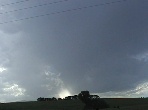
Taking a turnoff towards higher ground and a clearer view about 5km short of Orange and got a
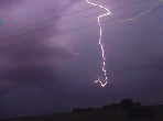
good view of the approaching storm. Several good CG's but most of the lightning was overhead
buried in the anvil.


Shortly after the rain started we headed back towards Orange to be hit by a hail storm. Everyone
in their cars were diving for shelter under what ever tree they could find. After 20 mins of that the
ground was totally covered with up to 10cent (1/2in) size hail, biggest hail storm I personally have
ever been in. It was very confined in area ... only a couple of km's wide, Orange totally missed it.
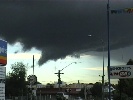
Whilst in Orange we observed the rear side of this storm. It had some good updraughts and a
very good,"inflow tail". It looked so much like a tornadic funnel angled at ~ 45 deg, with the
condensation obviously spiralling upwards could be seen on the video tape.

After checking weatherzone.com in Orange, we could see some more cells were on the way.
That took us back up onto the side road we visited an hour or so earlier. Following this storm back
towards Sydney we got a wonderful lightshow with many good movie clips.
I lost a lot of earlier pics of the cells and hail … one of the camera memory cards failed :(
 W of Orange thumb.jpg)
 thumb.jpg)
 thumb.jpg)
 thumb.jpg)
 thumb.jpg)
 thumb.jpg)
 thumb.jpg)
 thumb.jpg)
 thumb.jpg)
 thumb.jpg)
 thumb.jpg)
 thumb.jpg)
 thumb.jpg)
 thumb.jpg)
 thumb.jpg)
Below Lightning Tracker/Radar image courtesy of Weatherzone and BOM

copyright Dave Nelson 2006
Updated 10 Oct 2006
 To Top
 To Chase Index